In October 1884, twenty-five countries sat down in a conference room in Washington and voted on which line should count as the middle of the world. France lost the vote, abstained from the result, and kept the Paris meridian on its own charts for another twenty-seven years out of pride. That argument is the reason your phone today reads longitude from a brass strip set into the ground at a south-east London observatory.
Latitude was never really in dispute — the equator picks itself, sitting halfway between the poles because that’s where the planet’s own spin tells you it should. Longitude had no such natural anchor, which is why the political fight took so long. What I find genuinely surprising about the history is how recently the system settled. The grid is 2,200 years old, but the version of it your phone actually uses was finalised within the last 50.
The Greeks drew the first grid
Around 230 BC the Greek scholar Eratosthenes — the same man who calculated the size of the Earth by watching shadows in two cities — sketched the first coordinate system on a map of the known world. He drew lines parallel to the equator and lines running pole to pole. A century later Hipparchus formalised them as 360 degrees and proposed using astronomical observations to actually assign coordinates to specific places.
By 150 AD, Ptolemy’s Geography listed about eight thousand places with their latitude and longitude. He got the size of the Mediterranean wrong by 40%, but the framework is unmistakable. If you put a Ptolemaic coordinate next to a modern one for the same city, the format is exactly the same.
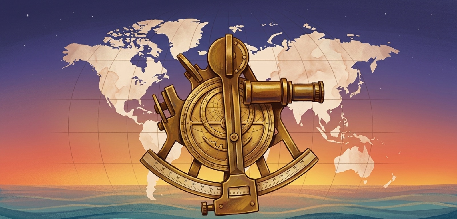
Latitude was the easy half
Finding how far north or south you are turns out to be straightforward if you can see the stars. The angle the sun sits above the horizon at noon, or the angle of the North Star above your spot in the northern hemisphere, gives you latitude directly. The instruments — the astrolabe, then the sextant — got better over the centuries but the principle never changed. Any decent ship’s captain in the 1700s could read latitude reliably from the deck of a moving ship.
Longitude was the disaster that killed people
Longitude requires you to know the time. If it is noon where you are — which the sun tells you — and it is, say, 4 PM at Greenwich, then the four-hour difference tells you how far east or west of Greenwich you are. The catch is that there were no clocks accurate enough to keep Greenwich time on a ship that had been at sea for weeks. Pendulum clocks were useless on a rolling deck. The astronomical alternatives were complex, slow, and only worked at night in clear weather.
The result was a regular slaughter at sea. Ships missed their islands by hundreds of miles and ran aground. In 1707 a British fleet wrecked itself on the rocks of the Isles of Scilly because the navigators had no idea how far east they were; nearly 2,000 sailors drowned in one night. Seven years later, in 1714, Parliament passed the Longitude Act, putting up what was then a colossal cash prize — £20,000, the equivalent of millions today — for a workable solution.

John Harrison’s clocks
John Harrison was a Yorkshire carpenter who taught himself clockmaking. Over forty years he built a series of marine chronometers — the first portable clocks accurate enough to keep Greenwich time on a wooden ship in a North Atlantic gale. His fourth attempt, H4, ran for 81 days at sea and lost less than five seconds. Longitude was solved. The Royal Navy still owed him most of the prize money for decades afterwards; he had to petition the king personally to get it.
All four of Harrison’s clocks still work and are on display at the Royal Observatory in Greenwich today. H4 is the size of a large pocket watch.
Whose meridian is zero?
With reliable clocks, every seafaring nation could measure longitude from somewhere. The French ran theirs through Paris. The Spanish through Cadiz. Americans through Washington. The Portuguese through Lisbon. Each country’s charts were unreadable on another country’s ships, and that became expensive once steamships and international cabling made commerce continuous.
The 1884 Washington conference settled it. Greenwich won — not because it was geographically special, but because British nautical charts were already the most widely used and reprinting every chart in the world was unappealing. France abstained out of pique and France’s civil railway clocks ran on “Paris time minus nine minutes 21 seconds” (the offset from Greenwich) until 1911, when they finally gave in.
From sextants to satellites
The instruments changed entirely; the coordinate system did not. GPS, launched by the US Department of Defense in the late 1970s and made fully available for civilian use in 2000, gives you latitude and longitude using exactly the definition Ptolemy used, accurate to a few meters instead of a few miles. The Galileo (EU), GLONASS (Russia), and BeiDou (China) systems all use the same grid. Your phone reads from all of them simultaneously and hands the result to whichever app asked for it.
What I think is worth pausing on: a Greek scholar in Alexandria, an English clockmaker in Yorkshire, and twenty-five governments arguing in Washington all contributed to the number your weather app needs to forecast for the right city. None of them could have imagined any of the others. That is the part of the history I keep coming back to.
See your own coordinates
Two clicks on the GPS Coordinates tool give you the latitude and longitude that took two millennia to make readable. The latitude number you see comes from astronomical principles a Greek scholar would have recognised; the longitude number comes from a Yorkshire clock and an 1884 vote.